Charting a Fictional Place

When I lived in central Pennsylvania, I spent many days hiking, hunting, botanizing, birdwatching, and riding horses out in nature. Those experiences gave me a deep understanding of the place I’ve used as a model for Colerain County, the setting for my Gideon Stoltz Historical Mysteries.

I also did a lot of research into what the region must have been like in the early 1800s.

Classic works of natural history like The Great Forest by Richard G. Lillard (1947) and A Natural History of Trees by Donald Culross Peattie (1948) presented observations on the land and nature in eastern North American in those early days.

I read travelers’ tales. Articles in historical journals. Thick county histories published in the late nineteenth century, when memories of the first years of settlement, land-clearing, and development in central Pennsylvania remained fresh.

Portion of 1816 map of the United States by John Melish. Credit: Wikimedia commons

Portion of 1816 map of the United States by John Melish. Credit: Wikimedia commons
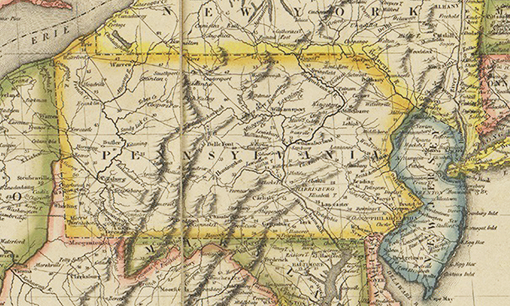
I also learned from maps. One in particular was a big help and a lot of fun to study. Created in 1820, it is part of the first official set of county maps produced for the state of Pennsylvania.

Someday I’d like to examine the original chart for Centre County (it’s in the state archives in Harrisburg), but so far I’ve made do with one that can be downloaded from the website of the Pennsylvania Historical Museum Commission. (Check it out HERE.)

The maps were the work of John Melish, a Scottish geographer, traveler, and entrepreneur. In 1816 Melish created the first map showing the United States extending to the Pacific Ocean. Soon after, the Pennsylvania legislature accepted his proposal to send surveyors to all the counties in the Keystone State and make detailed maps of each, which could then be combined into a map of the entire state.

After the surveyors handed over their completed maps to Melish, the charts were copied and then engraved. In 1822 the Pennsylvania legislature lauded the final product as “an exquisite specimen of graphic skill” and declared it well worth the $29,276.75 they had paid Melish for his ambitious undertaking.

The map for Centre County – the inspiration for my fictional Colerain County – is a lovely thing indeed.

The various townships are outlined in blue, tan, or light red. The handwritten text explains that in 1820 the county had a population of 12,490 and an area of 1,360 square miles, or 870,727 acres, “about one third part of which is susceptible of cultivation, one sixth part first rate land, and one tenth part cleared and cultivated.”

Under “Principal Towns and Villages,” the text states that “Bellefonte is the seat of Justice, containing an Academy, Court-house, and Jail.” (The jail is where Gideon has his office; his friend Horatio Foote is headmaster of the Adamant Academy.)

Symbols on the map depict houses of worship (a little building with a cross on top), mills, manufactories, furnaces, forges, post offices, dwelling houses, mineral deposits, and sinkholes. (In my second Gideon Stoltz mystery, Nighthawk’s Wing, a woman’s body turns up in a sinkhole, and Gideon is called to investigate.)

The map shows rivers, streams, hills, mountains, and roads. Some of the dwelling houses bear their owners’ names; you can see where Scotch-Irish settlers lived and where Pennsylvania Dutch folks dwelt.

Most of the place names on the map are familiar to me. Some I don’t recognize; they may denote settlements that have vanished, or perhaps the names are no longer in use. For instance, the place I know as “the Barrens,” a sprawling area of pitch pines and scrub oaks, is simply marked “Plains.”

Seeing those features, both physiographic and manmade, help me imagine Gideon Stoltz’s Colerain County and conjure up the mysteries he must solve there.

The surveyors who made the 1820 map of Centre County are identified as “Walter B. Hudson” and “An. Morrison.” Those fellows must have hiked their legs off. They did good work. Through the cartographer’s art, they created an intriguing map of a bygone place that I’m bringing to life in my fiction.